Robert Monroe, UC San Diego

Researchers at Scripps Institution of Oceanography, UC San Diego have developed a new method for improving atmospheric river forecasts based on collecting special observations using two aircraft in atmospheric rivers over the northeast Pacific Ocean.
The method was used for the first time in February in National Weather Service-directed flights over the Pacific Ocean. Atmospheric rivers are corridors of moist air and strong winds that can deliver large portions of California’s annual precipitation in a matter of days.

“The data collected during this study will be used to evaluate the effectiveness of improving the computer model forecasts of heavy rainfall during these winter time events by providing high-resolution information within these rivers of moisture that flow over the Pacific Ocean into areas along the West Coast,” said Lt. Col. Jon Talbot, 53rd Weather Reconnaissance Squadron senior meteorologist.
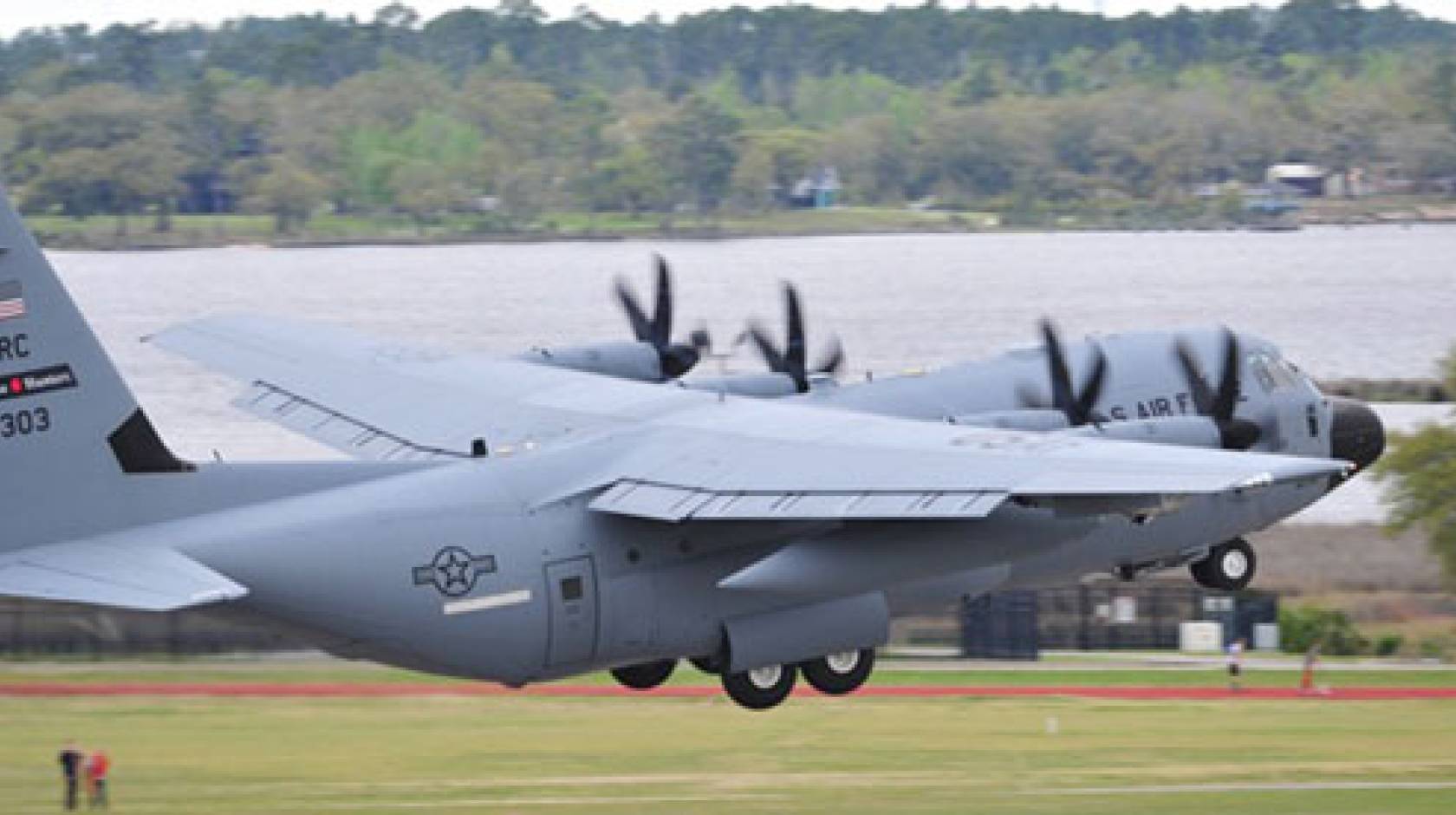
Scientist F. Martin Ralph, director of the Center for Western Weather and Water Extremes at Scripps, said the observations made aboard two U.S. Air Force C-130 aircraft were aimed at improving forecasters’ ability to say exactly where atmospheric river storms will make landfall and produce heavy rain. Current forecasts of landfall location of ARs made one to three days in advance are typically off by 300 kilometers (200 miles).
The inaccuracy is especially acute in forecasts of precipitation events related to atmospheric rivers. Sometimes the inaccuracy is so great that storms miss entire watersheds that had expected to be inundated with rain or snow, impacting adjacent areas that may or may not have been prepared. As with hurricanes, improvements in atmospheric river storm tracking capabilities can inform decisions at state and county levels to take potentially life and property-saving emergency measures.
A new chapter in West Coast weather prediction
Ralph said the mission represents a new chapter in West Coast weather prediction by bringing the capabilities of the Air Force’s Weather Reconnaissance Squadron to bear on the challenges of observing atmospheric rivers and improving prediction of their landfall.
“While many key data are provided by satellites and other sources over the oceans, they lack the ability to adequately observe both the winds aloft and the water vapor aloft in atmospheric rivers themselves,” said Ralph, an expert on atmospheric rivers and the developer of the reconnaissance mission this winter. “These gaps, including subtle differences in the patterns of water vapor, winds, and temperatures, are greatest within atmospheric rivers and their precursor weather conditions offshore and are the top cause of forecast errors in AR landfalls.”
During three February storms, the two aircraft flew over the north Pacific. One aircraft was based in Hawaii. The second aircraft flew two missions from near Seattle and the third from near San Francisco. The researchers deployed dropsondes from the aircraft, small cylindrical tubes containing instruments that make detailed measurements of water vapor and wind speed and direction as they fall to earth. In coordinated flights, two aircraft deployed the dropsondes roughly every 50 miles across the full width of each AR. This creates a multidimensional view of the ARs. The data was fed in real-time to the weather prediction models at the National Center for Environmental Prediction and other global weather prediction centers
The Scripps-NOAA-Air Force data-collection flights led by Ralph complement two similar missions led by NOAA that employed manned and unmanned flights to observe atmospheric conditions in the tropical Pacific Ocean. All three took advantage of one of the strongest El Niño seasons in the past 60 years to view the evolution of storms. This operational mission built upon a decade of past research, and coordinated with current research that used other aircraft also sampling storms this winter over the Pacific.
This mission is also one of several efforts at Scripps designed to observe this year’s event using methods that were less developed or nonexistent during the last major El Niños.
Better forecasts support water managers, too
The suite of Scripps’ projects includes a survey of the Southern California coastline by aircraft-mounted light-detection and ranging, or lidar, instruments. Lidar creates detailed measurements of coastal topography as El Niño changes the shape of beaches and cliffs. Another study will send Scripps researchers to California’s coastal waters in April to examine El Niño’s effects on California Current marine life during a time of year when nutrients are propelled to the ocean surface from deep waters. Other researchers are enlisting the public’s help to document the evolution of El Niño’s effects on the coastline and estuaries at ground level with photos.
“Better forecasts of landfalling atmospheric rivers can help with precipitation and river predictions in ways that support water managers in California,” said Jay Jasperse, chief engineer of the Sonoma County Water Agency, which oversees operations for a key reservoir that helps supply water to 600,000 people.
“Atmospheric rivers are the key to our area’s water supply, and to flood risk,” said Jasperse. “These efforts by Scripps, NOAA, and the Air Force are welcomed as we develop new methods to support water management in this drought-prone region, including exploring the use of Forecast-Informed Reservoir Operations. Better information on approaching atmospheric rivers, such as being developed by Scripps’ Center for Western Weather and Water Extremes and its partners, are vital to our water operations.”

